Public Safety
City’s Floodplain Management Means Residents Can Save on Cost of Flood Insurance


Many residents express concerns that it won’t fix traffic problems
If the term “roundabout” conjures up images of Chevy Chase caught in an endless circle in the 1985 film, “National Lampoon’s European Vacation,” you probably haven’t given the more modern versions here in metro Atlanta much of a chance.
Peachtree Corners plans to add a second roundabout in the city, adding to the first one built in 2018. That one, at Medlock Bridge Road and Peachtree Corners Circle, generated hundreds of social media comments from residents and stakeholders who were frustrated with the chosen solution for the busy intersection.
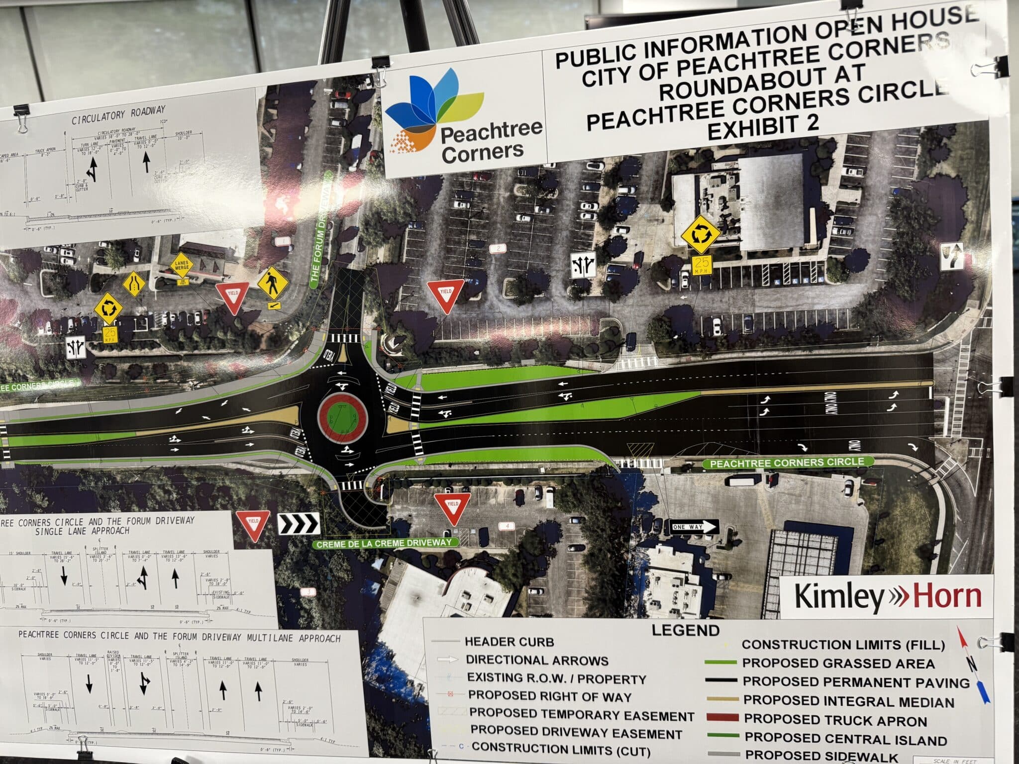
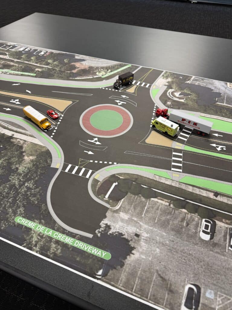
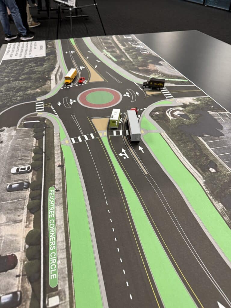
Hoping to alleviate some of the angst this time, a public information meeting on March 27 gave those interested in the planned roundabout at Peachtree Corners Circle — positioned between The Forum entrance and Crème de la Crème — an opportunity to look at the plans. About 20 people showed up.
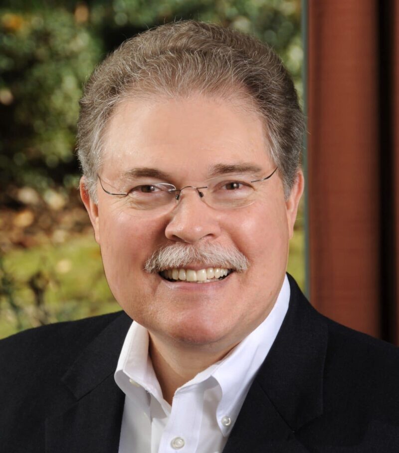
Peachtree Corners Public Works Director Greg Ramsey, who facilitated the open house, said some who came in with the opinion that the roundabout wasn’t a good idea had changed their minds by the time they left.
“We had one couple who came in who said they didn’t like the idea at first, but after watching the videos and seeing the renderings and talking to our staff and our design team, that that they had their minds changed, that they felt like it’s going to be a positive change and a positive addition and safer for the entire community,” he said.
Designed to improve traffic flow and safety, this new intersection will feature pedestrian-friendly crossings, dedicated bike lanes and better access to local businesses, according to the city. Peachtree Corners officials and engineers from Kimley-Horn shared insights on the design, traffic impact and construction timelines.
High rate of traffic crashes
When the first roundabout opened, Ramsey told the Atlanta Journal-Constitution, “Roundabouts promote a continuous flow of traffic in all directions versus a traditional traffic signal that stops at least one direction at all times. The roundabout allows for a greater volume of traffic through an intersection while minimizing delays, particularly during off-peak hours.”
He still believes it’s the best solution for many blocked areas.
Back in January of 2022, the city of Peachtree Corners commissioned a study to determine what type of traffic calming device would help alleviate congestion and cut down on crashes along Peachtree Corners Circle between The Forum’s major driveway and Peachtree Parkway.
Crash data for the five-year period between January 1, 2017 and December 31, 2021 showed that approximately 69% of the 36 crashes reported in the area were property damage only, and just one crash resulted in suspected serious injury.
Crashes were also evaluated based on the manner of collision. Approximately 83% of the total reported crashes within the study area were either angle or rear-end type crashes. Each had 15 occurrences. Sideswipes and single-vehicle crashes were also reported within the analysis window.
- The highest crash frequency occurred in the right-turn lane approaching Peachtree Parkway. Seven rear-end-type crashes occurred within the turn lane.
- The second highest crash frequency occurred at The Forum’s main driveway, where six crashes were caused by drivers turning left from The Forum crashing with westbound through-traffic on Peachtree Corners Circle.
- Three sideswipes occurred in the westbound lanes of Peachtree Corners Circle just west of Peachtree Parkway.
- Of the total reported crashes within the study location, 12 occurred at the intersection of Peachtree Corners Circle and The Forum’s major driveway.
- Of the 15 reported rear-end crashes, 10 of them occurred at the intersection of Peachtree Parkway and Peachtree Corners Circle.
- Of the 14 crashes reported at The Forum’s major driveway, nine were angle crashes.
- Six of the eight reported crashes at The Forum’s minor driveway/QuikTrip driveway were angle crashes. One of these reported angle crashes involved a bicyclist, who was seriously injured.
Because angle crashes cause the greatest number of fatalities and injuries of all crash types, safety improvements were a high priority in this intersection control study.
Why here, why now?
Prompted by the crash rates, the next step was to find a solution. Due to multiple conflict points that involved vehicles, pedestrians and high traffic volumes (locations where the paths of road-users coincide, representing potential crash areas and categorized as crossing, merging, diverging or pedestrian interaction), several options were ruled out.
“The need was a safety one. There are a lot of conflict points out there between vehicles turning in all directions and pedestrians in the area as well,” said Ramsey. “There’s a daycare and gas station there and very high traffic volumes at certain periods of the day.”
This particular intersection proved tricky because of the volume and variety of traffic.
“With four or five driveways and lots of traffic dumping onto the street coming from The Forum and other businesses there, you can imagine multiple periods of high volume — like the lunch hour rush,” he continued. “Additional traffic is being projected as well for multi-family [structures] that have been rezoned in that development.”
He added that many people also feel the need to speed through the intersection.
“Unfortunately, a lot of that traffic is going at a high rate of speed and so some of these crashes and near misses that we’ve seen are extreme.”
Improved safety and feasibility
Traffic studies and feasibility reports approved by Gwinnett County to reduce accidents and improve traffic flow in the area showed that traditional traffic signals are impractical due to proximity to 141.
With the success of the roundabout at Peachtree Corners Circle and Medlock Bridge Road, though, Ramsey said once people get used to it, they’ll find that it is for the better.
“It certainly has improved safety at that intersection, and we’ve been very pleased with how it turned out,” he said. “Incidentally, there was a lot of negative community feedback when that roundabout was proposed, but ironically, two years after that project opened, the Atlanta Journal-Constitution wrote an article saying, basically, ‘Hey, this turned out to be okay after all.’”
The city council has funded the new project design and conceptual development, as well as the traffic study, so right now it’s progressing forward, Ramsey added.
“This is not like a rezoning where there’s public hearings, it’s just a public project that the city has in its annual capital improvement program, just like a number of other intersection improvements that we’ve done, are doing and will be doing,” he said.
How roundabouts help with traffic
Ramsey shared that roundabouts act in two ways.
“Number one, it’s a traffic calming mechanism. It slows people down and slower traffic is safer traffic, especially when pedestrians are involved. And at the same time, it keeps traffic moving,” he said. “And then at the same time again, not stopping at a red light, having to sit there idling your vehicle and sitting in the hot sun is a plus — traffic is always flowing.”
He pointed out many cities in Europe as well as the city of Carmel-by-the-Sea are big proponents of roundabouts. He added that there are cities in Indiana that would like to do away with traffic signals altogether and use roundabouts exclusively. Metro Atlanta has several examples as well, including the Riverside Drive on-ramp to I-285.
The next phase of the project is sending out a request for proposals for construction. Ramsey said it should be out by late summer/early fall.
“It’s a rough timeline right now, and there’s nothing set in place for a variety of factors — right-of-way and easement acquisition needs that are required,” he said.
Right now the timeline is looking like completion will be in 18 months or so.
Public reaction
The comments on the Peachtree Corners Life Facebook page a few days after the open house were a mixed bag.
Gail Livor Glattli: Hate those things. Nobody knows how to use them correctly.
Actually, roundabouts are pretty easy to navigate, said Ramsey.
“Obviously, you’re going to approach something new. We hope you’re paying attention about how to get through it,” he said. “But then the second, third and many times after they go through it, I think the comfort level grows. And certainly if you’re not distracted with your phone or other devices in your vehicle, paying attention to the signage and the channelization of the roadway is doable.”
Doug Edstrom: Oh boy, can you offer a free training class on how to proceed through one of these?
The Federal Highway Administration has a YouTube video that explains how to navigate roundabouts.
Karin Arranz: Traffic there is a cluster. Hopefully this will help fix the near misses we deal with daily.
Michael Falkner: Thank goodness. Anything is better than that current mess.
Glen G. Gordon: This is badly needed and will help tremendously. I like that the crosswalk at the Forum driveway is set back a bit.
Port Rose Kaufman: Why don’t they just put up a light at that corner? I’ve seen at least 10 accidents there over the years.
Ramsey said a traffic signal isn’t allowed there.
“It’s too close to 141 for a traffic signal with the standard red light, green light at that intersection,” he said. “It’s against GDOT standards to put in a signal at that close proximity. It would actually back up traffic into 141, which would make that heavy intersection even worse, and that’s certainly something we want to avoid.”
Bob Ballagh: A whole lot better than the current intersection.
“Obviously, we’ve got a few people who are just against the idea, but I’m not sure that we’re going to ever be able to make everybody happy,” said Ramsey.
“We’re trying to make the best solution possible. There’s going to be some discomfort with change for some people on everything we do, but we believe this is the best solution of those that are available to us.”
For more information about the project, visit peachtreecornersga.gov/1449.
Ramsey also encouraged residents and stakeholders with questions to contact his department at publicworks@peachtreecornersga.gov.


Katherine Lafourcade — A Journey of Passion, Resilience and Giving Back

GA Tech Launches First-of-its-Kind GT Atrium in Peachtree Corners

Digital Edition

PCBA Announces 2025 Scholarship Winner

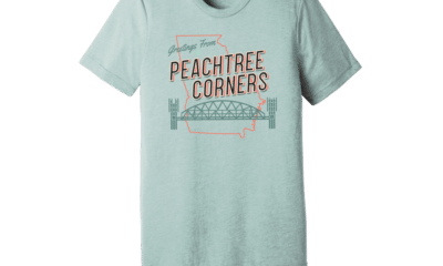
Official City Merchandise Line Debuts This Saturday at Town Green

Paul Duke STEM High School Student Earns CGO Scholarship

World Blood Donor Day Starts Here: Theo’s Miracle, Katherine’s Mission [Podcast]

Executive Function: A Tribute to Working Moms

City of Peachtree Corners Awarded Certificate of Achievement From GFOA for Seventh Straight Year

Simpson Elementary Marks Exceptional Children’s Week
Executive Function: A Tribute to Working Moms
Official City Merchandise Line Debuts This Saturday at Town Green

Peachtree Corners Grows Business Opportunities Through Economic Development
Digital Edition
World Blood Donor Day Starts Here: Theo’s Miracle, Katherine’s Mission [Podcast]
Paul Duke STEM High School Student Earns CGO Scholarship

Light up the Corners [Video]

Capitalist Sage: Business Leadership in Your Community [Podcast]

Cliff Bramble: A Culinary Adventure through Italy

Top 10 Brunch Places in Gwinnett County

A Hunger for Hospitality

THE CORNERS EPISODE 3 – BLAXICAN PART 1

Top 10 Indoor Things To Do This Winter

The ED Hour: What it takes to Remove Barriers from Education
-

 City of Peachtree Corners5 days ago
Official City Merchandise Line Debuts This Saturday at Town Green
-
Community4 days ago
Executive Function: A Tribute to Working Moms
-
Business5 days ago
Peachtree Corners Grows Business Opportunities Through Economic Development
-
Community4 days ago
Simpson Elementary Marks Exceptional Children’s Week